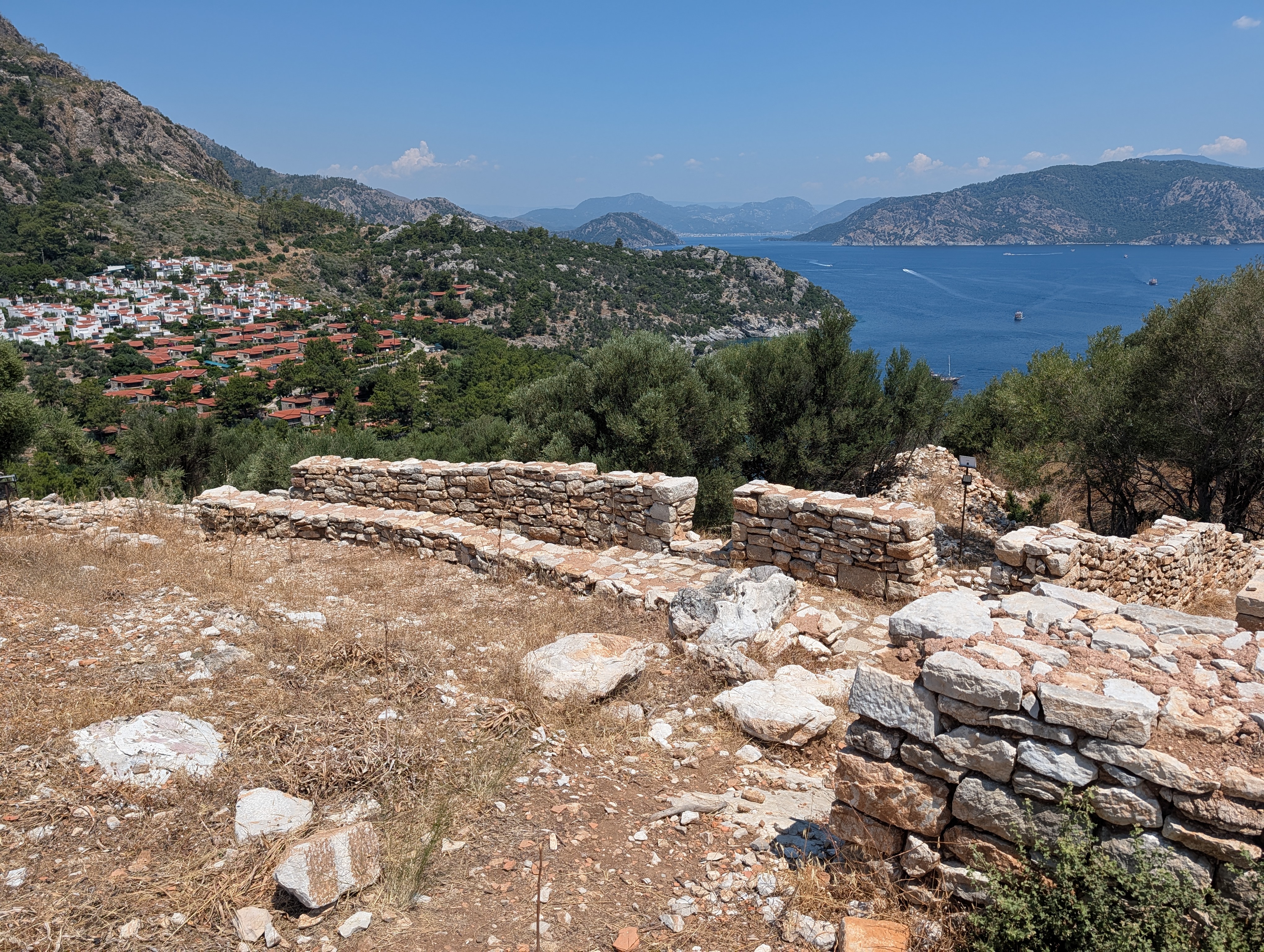
Perched on a steep, rocky hill above the cerulean waters of the Mediterranean, the ruins of ancient Amos command a spectacular stretch of the Carian coast. The settlement occupies the elongated Asarcık promontory, rising between two sheltered bays and offering wide views across the surrounding sea and hills. Its surviving walls, theatre, sanctuaries, and recently excavated domestic buildings reveal the remains of a small but remarkably well-organised ancient community, once connected with the powerful Rhodian world across the water.
For centuries, however, Amos remained little more than a name and a scattering of ruins on a wooded hillside. Today, a new generation of archaeological excavations is gradually changing that picture, revealing unexpected evidence for the settlement's much earlier origins and providing fresh insights into the lives, beliefs, and daily activities of its inhabitants. Easily reached from the nearby resort of Turunç, Amos offers something increasingly rare: the opportunity to explore an ancient city while its history is still being uncovered.
Historical overview:
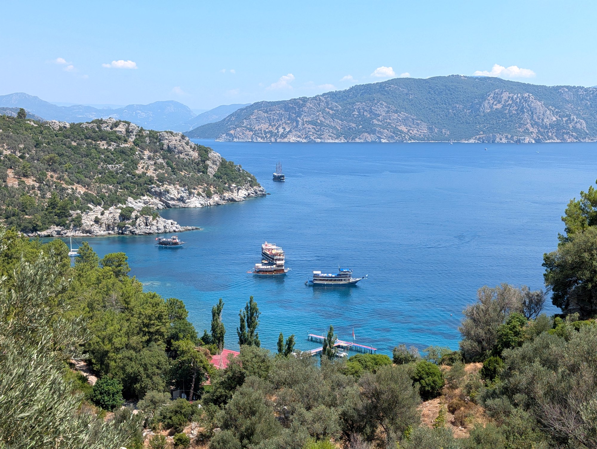
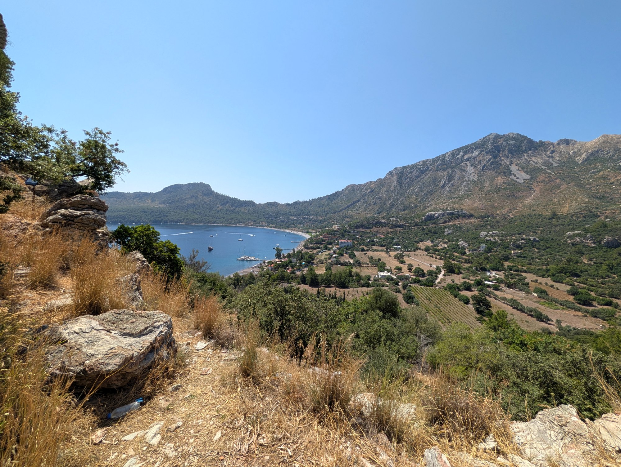
The site of the settlement must have been carefully chosen: on the slopes and the top of the hill now known as Asarcık which projects around 400 meters into the sea and reaches the height of about 100 meters above the sea level. Two natural bays located to the north (Asarcık Bay) and the south (Kumlubük Bay) of this small peninsula may have served as natural harbours to the city.
The name of the settlement — Amos — has uncertain origins and is problematic as the ancient sources offer two forms. The first one — Amos — comes from an important geographical dictionary entitled "Ethnica" written by Stephanus of Byzantium in the 6th century CE. The second one — Ammos — was recorded by the author now identified as Pseudo-Aeschines to distinguish him from one of the greatest Athenian orators and politicians of the 4th century BCE. One of the pseudo-Aeschinean letters describes Ammos in the Rhodian Peraea, on the Carian mainland opposite Rhodes and discusses the agricultural land around the place, including olive trees, vineyards, and cultivated fields. This description was used by the researchers to identify the geographical setting of the passage with the archaeological site of Amos near modern Turunç.
Whether Amos or Ammos, the most common interpretation of the settlement's name is from the Greek word meaning sand or sandy ground. This may be valid for geographical reasons because the peninsula where the settlement is located lies between two sandy bays. On the other hand, the steep promontory where the ruins are situated is rocky rather than sandy so some doubts to the origin of the name remain.
There are also other theories explaining the meaning of the city's name, but they do not have much supporting evidence. They include the relation with some Carian or Luwian name from the period before the Greek colonization of the area, the connection with biblical Amos — one of the Twelve Minor Prophets of the Hebrew Bible and Christian Old Testament, or even the link with some Ugaritic names. Out of these theories, the Carian name seems more probable than the others, especially as the recent excavations moved back the history of the settlement to at least the 10th century BCE. That makes the question whether the name is a pre-Greek survival considerably more worth investigating than older descriptions of Amos suggested.
Thus, according to the most recent research, the history of the settlement in this particular location dates back to the 10th century as supported by archaeological evidence. This includes an apsidal building located beneath the later temple on the acropolis of Amos. It was discussed in 2022 in the publication "The Traces of the Early Iron Age at Amos" by Mehmet Gürbüzer. The discovery was made during excavations in 2021 on the acropolis. Archaeologists discovered the remains of an apsidal building, which they dated to approximately the 10th century BCE. As such this is currently the earliest archaeological evidence reported from Amos and moves the known history of the site back by several centuries from the earlier-suggested beginnings in the Classical period of history. Importantly, the previous earliest archaeological evidence found at Amos had been dated to the 6th century BCE.
Interestingly, the discovered structure was not a dwelling but held some other role, associated with a cremation area located just outside it. Moreover, there were two intramural burials beneath its floor. These facts suggest that people were cremated next to the building and then buried inside. Both of the two discovered burials consisted of human remains buried in amphorae. However, the amphorae were of different types, as one of them was a relatively coarse, undecorated belly-handled amphora while the second one was a neck-handled amphora decorated with concentric circles. Mehmet Gürbüzer suggested that the first one held the remains of a woman, while the second one - of a man. This is an interpretation based on the analysis of burial customs known from the period but not on skeletal remains so it is still just a hypothesis.
The researchers also compared the apsidal building from Amos with a similar structure known from Lefkandi on island of Euboea. There, a highly important Early Iron Age building was found, that also contained the burials of a man and woman. The Lefkandi building has generally been interpreted as belonging to an individual of high status, commonly referred to as a chief or a member of a local elite. Because of this similarity, Gürbüzer proposed that the apsidal building discovered in Amos may also have belonged to a high-status individual of a local chieftain.
Therefore, the current state of knowledge confirms that there was Early Iron Age occupation at the site of later Amos. On the other hand, this does not mean that a whole city existed there as the archaeological evidence is limited to the apsidal building on the acropolis. The history of Greek colonization of the area is also far from certain, even if traditionally Amos was described as founded by Dorians from Rhodes, most likely from Lindos, no later than the 7th century BCE.
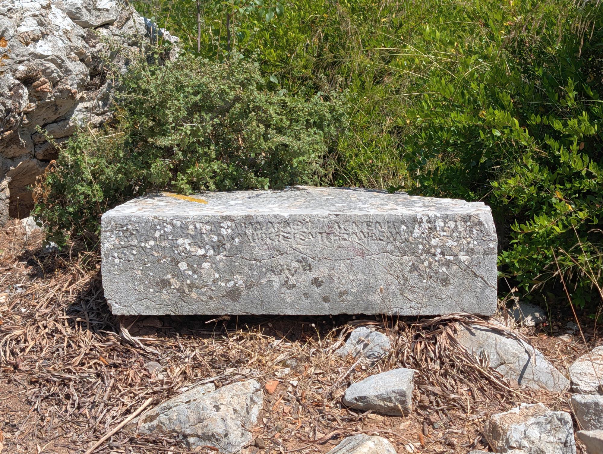
However, among several important pieces of epigraphic evidence from Amos, the most significant and the earliest discovered so far is a grave inscription from the 6th century BCE. Significantly it was written in the Knidian alphabet — a local version of the Greek alphabet used at Knidos, an important Doric Greek city on the Carian coast in southwestern Asia Minor, 80 kilometres to the west of Amos. It was not a separate language and the differences between this version and other Greek alphabets of the era were mainly in the shapes of letters, the forms of certain vowels and consonants, and some local spelling conventions. This 6th-century grave inscription from Amos shows Greek presence in the area well before the Classical period. On the other hand, it complicates the traditional picture of Amos as the colony settled by the people from Lindos on Rhodes island because they used another version of the alphabet.
In the Classical period, Amos is traditionally described as situated within the Rhodian Peraia in Caria. The Rhodian Peraia was the name of the southern coast of the region of Caria in western Asia Minor between the 5th and 1st centuries BCE, when the area was controlled and colonized from the nearby island of Rhodes. Modern scholarship has traditionally reconstructed the Rhodian Peraia as being divided into communities associated with the three Rhodian cities: Lindos, Ialysos, and Kameiros.
Already in classical times, before their unification and the creation of the unitary state of Rhodes in 408 BCE, the three city-states of Rhodes, i.e. Lindos, Ialysos, and Kameiros, possessed separate territories on the mainland of Asia Minor. These included the Cnidian peninsula, but not Cnidus itself, as well as the nearby Karian Chersonesos in the south (modern Bozburun peninsula) where Amos itself is located, and the region immediately to the east. Like Rhodes, these territories were administratively divided into demes, and their inhabitants were citizens of Rhodes.
During the Hellenistic period the extent of the Rhodian Peraia grew with the addition of various vassal regions. It reached its greatest extent after the Treaty of Apamea in 188 BCE, when the whole of Caria and Lycia south of the Maeander River came under Rhodian rule, but this was short-lived; when Rhodes submitted to Rome in 167 BCE, this region was lost again. During this period, the Rhodian Peraia comprised a fully incorporated portion, situated between Cnidus and Kaunos, which as before was divided into demes and formed part of the Rhodian state, and the rest of Caria and Lycia, which were tributary to the island. Rhodes retained a part of its ancient dominions in Asia until 39 BCE when these were ceded to Stratonicea.
Within the Rhodian Peraia the city of Amos was, most probably, connected to Lindos, but the nature of their relation is far from clear. An important study by P. M. Fraser and G. E. Bean, "The Rhodian Peraea and Islands", published in 1954, concluded that the demes of Lindos included Physcus and Casara, and probably Amos and this is the basis of the traditional link between Amos and Lindos. Moreover, a much more recent research by Mehmet Gürbüzer went a little further, describing Amos as having become part of the Rhodian Peraia "as a Lindian deme" during the Hellenistic period. It is important to bear in mind that the evidence does not prove that Lindian colonists founded the settlement, but that Amos and Lindos were politically connected.
The earliest securely documented historical appearance of Amos in the written record is the Athenian tribute list under the ethnic name Amioi. Actually, Amos was recorded only once, in the period 428/427 BCE when it made a payment of 2250 drachmas. However, Amos was not recorded there as a separate settlement but under the name Kherronēsioi, meaning the people of the Peninsula, i.e. the Karian Chersonesos, corresponding to the modern Bozburun Peninsula. The names of the other members of this group were not preserved and only a part of the second member is known — Ler... — possibly Loryma while the third name is now completely lost.
On the other hand, the literary references to Amos are relatively scarce. The first and the earliest one is preserved in the pseudonymous letters attributed to the Athenian orator Aeschines. Although the historical Aeschines really did go into exile and lived at Rhodes after 330 BCE, the surviving letters bearing his name are now generally regarded as later compositions, probably dating from the early Imperial period or later. They describe Amos and its fertile countryside, mentioning olive trees, vineyards, and agricultural land that was leased to cultivators. Their account is noteworthy because independent inscriptions from the territory of Amos record the leasing of agricultural estates. Thus, while the pseudo-Aeschinean letters are not reliable evidence that the historical Aeschines personally owned an estate at Amos, their description of Amos as an agriculturally productive territory is consistent with the independent epigraphic evidence for land leasing there.
The second literary source sometimes quoted in the context of Amos is the "Stadiasmus Maris Magni", literally meaning "Coastal Survey of the Great Sea". It is a short ancient maritime itinerary, giving sailing distances between coastal places and harbours. Its surviving text is conventionally dated to the 3rd century CE. In the relevant passage, the text reads: "from Rhopusa to Samos (Amos?), 100 stadia" and "from Samos (Amos?) to Poseidion, 60 stadia".
The vital point of debate is that the surviving text actually says "Samos", suggesting the Aegean island, not Amos in Asia Minor. However, modern scholars consider this an error and identify it with Amos instead, on the basis of the distances given and the identification of the ancient place names with modern locations. Rhopusa has been identified with modern Yılanlı Adası (Snake Island), to the southeast of Marmaris, and Poseidion — with Kadırga Peninsula, to the south of Marmaris. The distances given are much more compatible with the location of these places in relation to Amos that Samos because, using the conventional Greek stadion of approximately 185 meters, we get the distances of just 18.5 and 11 kilometres from Amos.
The third and the final ancient literary source to mention Amos was the 6th-century "Ethnica" written by Stephanos of Byzantium, who described it as a city of Caria. However, this source is not a definite proof that Amos was still a significant city in this period because Stephanos compiled his geographical lexicon often drawing from much earlier sources.
A set of three inscriptions, found in 1948 and subsequently published by Alain Bresson in his major corpus "Recueil des inscriptions de la Pérée rhodienne", informs us that around 200 BCE Amos had a board of hieromnamones, i.e. sacred record-keepers. They were a board of civic officials responsible for keeping and remembering legal agreements and other juridical proceedings. The inscriptions (conventionally numbered SEG 14.683; 14.684; 14.685) offer us a glimpse into the civic life of the city of Amos in the recorded period, especially into the precise responsibilities of the sacred record-keepers and their roles within the local community.
First of all, they administered the agricultural land leased by the community of the town to individuals for various periods of time, up to 50 years. They also collected the rents in the name of the Amos community and if the tenant failed to pay for the lease, penalties were imposed upon him and the land could be subjected to the re-lease to the highest bidder.
The second responsibility, very straightforward but crucial, was to deal with the changes of tenants — when this happened, the hieromnamones drew up new contracts, checked the guarantors of the prospective tenant, and then recorded the whole transfer with the date and the names of the interested parties. The whole record was inscribed on a stele at a local temple for everyone to see.
The third role of the sacred record-keepers was to enforce the lease conditions such as the maintenance or construction of the buildings located within the leased land, preservation of its boundaries and roads, and proper cultivation of vineyards and fig trees. The failure to do so resulted in financial penalties payable to the community of Amos. Moreover, and this is a fascinating detail, it was forbidden to bury the dead in the leased land and breaking of this rule resulted in a fine of one hundred silver drachmas and the obligation to remove the deceased.
Finally, we can learn that behind this sophisticated system of land lease administration was the Rhodian state and if the citizens of Amos did not enforce these laws, they would have to pay a large fine to "the city" — in this case the city of Rhodes. This fact demonstrates something important about Amos' position in the Rhodian Peraia — while it had its own officials, the administration of the town operated within the framework and authority of Rhodes. This indicates that the inhabitants of the Rhodian Peraia, and thus Amos as well, were full Rhodian citizens.
The new 2026 study by Mehmet Gürbüzer and Emre Mandacı "Karia Khersonesosu Ölü Gömme Gelenekleri Üzerine Yeni Bulgular: Amos Nekropolisi'nden Bir Podyum Mezar" ("New Findings on the Burial Traditions of the Carian Chersonese: A Podium Tomb from the Necropolis of Amos"), published by the Turkish Historical Society, reports the first systematic excavation of a tomb in the Amos necropolis, and, what's more, the first scientifically excavated tomb in the Karian Chersonese. The tomb was constructed in the 3rd century BCE and continued to be used until the 3rd century CE. It sheds some light on the local burial customs and practices in the Bozburun Peninsula.
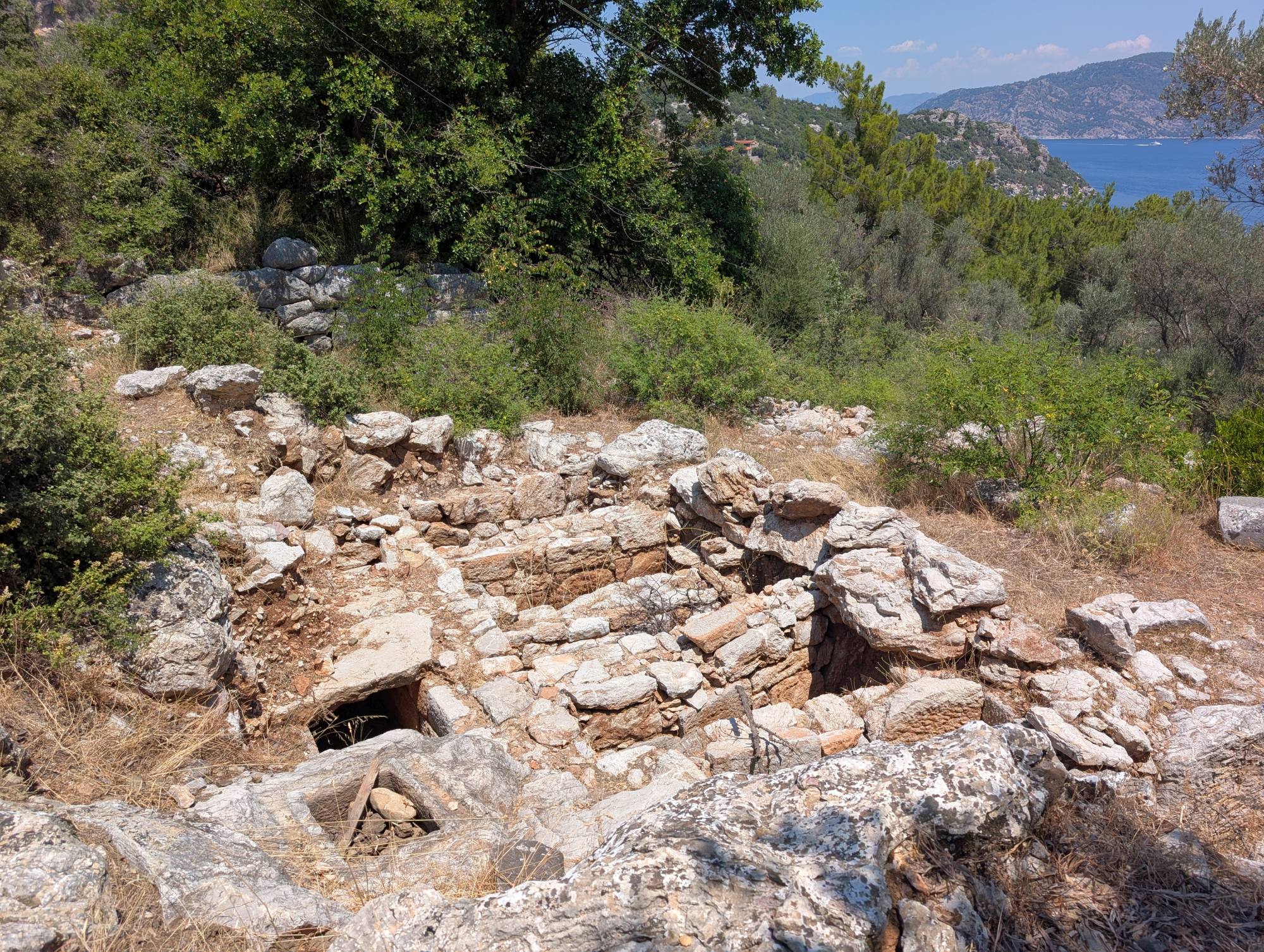
The tomb was constructed for a family, with ten compartments for the deceased. Interestingly, two different burial methods were recorded for the tomb: inhumation where the bodies were buried intact and cremation where the remains were only deposited after burning. Also, very significant is the coin assemblage found within the tomb, consisting of seven coins, including an Ialysos coin, two Rhodian coins, a coin of Lucius Verus, a coin of Julia Domna, a coin of Marcus Aurelius, and finally a coin of Alexander Severus. As this emperor ruled from 222 to 235 CE, the coin gives us the latest firm chronological marker for use of the tomb.
The dating of the tomb is also significant for dating the final period of the city's existence. The end of the settlement came as a result of a series of earthquakes that occurred in the 3rd century CE. This fact is the result of archaeological excavations within the city's theatre where earthquake damage was identified. Moreover, the archaeologists discovered a substantial burn layer inside three rooms of the stage building. Excavation director Mehmet Gürbüzer interpreted this combination of the ash deposits and structural damage as evidence of destructive events in the 3rd century CE. The earthquakes were sufficiently severe and struck the area with considerable force so that the theatre — the city's most prestigious building — ceased to be used, and the settlement was subsequently abandoned and was not inhabited again. More precise dating of these earthquakes is possible because of the family tomb discussed above — as it was still in use during the reign of Alexander Severus. Thus, the earthquakes most probably occurred after 222 CE.
Archaeological research:
The first modern-era explorer who recorded the existence of the ancient ruins on Asarcık Hill was Richard Hoskyn who served as a Royal Navy officer and hydrographic surveyor aboard HMS Beacon. He conducted the survey of the coast of southwestern Anatolia in 1840-1841, with the main focus on the parts of Lycia and southwestern Caria. The expedition recorded geographical and hydrographic data and the findings were subsequently published by Hoskyn in 1842 in the Journal of the Royal Geographical Society as "Narrative of a Survey of Part of the South Coast of Asia Minor; and of a Tour into the Interior of Lycia in 1840-1". However, while Hoskyn recorded the existence of the ruins in this location, he did not know it was Amos. Instead, he identified the settlement as "Samos", following the erroneous name preserved in the "Stadiasmus Maris Magni", discussed above.
The decisive identification of Amos and the correction of Hoskyn's error came only half a century later, when the French epigraphist Maurice Holleaux re-examined an inscription from Megiste (modern Kastellorizo) that had previously identified its dedicatee, Sosicles son of Nikagoras, as a Samian. Holleaux recognized that the ethnic had been misread: it should be (Amios), "of Amos". The inscription recorded Sosicles as an Amosean who had served as an epistates at Kastabos and at a tower on Megiste. The corrected reading fitted both the Doric character of the inscription and the political geography of the Rhodian Peraia, and Holleaux consequently identified the ruins at Asarcık as ancient Amos. He presented his findings in "Notes épigraphiques" published in the "Bulletin de Correspondance Hellénique" in 1894.
At the same time, the inscription from Megiste is valuable evidence for the administrative network of the Rhodian Peraia. It demonstrates that an inhabitant of Amos could hold an official position at other strategic locations within the Rhodian-controlled territory and provides an early piece of evidence for the political integration of Amos into the Rhodian world, independently of the later Hellenistic land-lease inscriptions.
The first archaeologist who visited the correctly identified site of Amos and recorded its architectural remains was Antonino Maiuri, an Italian classical archaeologist. He later gained considerable fame for the work at Herculaneum and Pompeii in Italy. He visited Amos during his exploration of Caria in 1921-1922 and his observations were published in 1924 in "Viaggio di esplorazione in Caria" for "Annuario della Scuola archeologica di Atene e delle missioni italiane in Oriente". There he described the principal surviving architectural remains at Amos, including its fortifications, the theatre, and the sanctuary.
Importantly, Maiuri did not carry out any archaeological excavations in Amos but only explored and described its visible remains. Thus, his account is an important early record of the condition and appearance of the site and as such his observations provide a historical baseline for the condition of the site before modern archaeological intervention. Moreover, later research and excavations have considerably refined what Maiuri could see during his visit.
Maiuri's account recorded the existence and the state of preservation of the following structures in Amos: the city walls and towers, the theatre, the temple area, and the general arrangement of the remains on Asarcık Hill. However, while Maiuri documented Amos, he did not produce the kind of systematic architectural survey that modern archaeology requires. Specifically, the 2021 study by Gürbüzer explicitly explained that before the renewed research, there had been no comprehensive study of Amos, and consequently no up-to-date city plan or modern topographical map had been available.
Nearly three decades later, in 1948, the British archaeologist George Ewart Bean began archaeological investigations at Amos. His main contribution to the understanding of the city was documenting its inscriptions and revealing important evidence for the city's political and economic life. George E. Bean's investigations at Amos marked an important turning point in the study of this ancient city. Unlike the earlier visits of Richard Hoskyn and Antonino Maiuri, which primarily just recorded the visible remains, Bean undertook a systematic examination of the site and its immediate surroundings, documenting its remains, such as fortifications, a theatre, a sanctuary, and other surviving structures. His work was especially significant for recording inscriptions, many of which were subsequently presented in his major study with Peter M. Fraser, "The Rhodian Peraea and Islands", published in 1954. This work established much of the documentary foundation on which later research into Amos has been based.
Bean's most important contribution was the discovery and documentation of a remarkable group of Hellenistic inscriptions, including the agricultural lease documents, dating to around 200 BCE, already discussed above in much detail. Bean also recorded inscriptions illuminating the religious and civic life of Amos. Among them was a temple inventory listing valuable dedications, and these inscriptions indicate that the people of Amos worshipped Apollo under the name Apollo Samnaios. The epithet Samnaios appears to have been unique to the people of Amos, as the name has not been encountered anywhere else.
Moreover, the existence of extensive wine production at Amos is evidenced by a fragmentary altar to Dionysos in the area of the theatre's orchestra. The coexistence of the cults of Dionysus and Apollo, two contrasting cults, is above all an indication that Amos was a typical Carian city. Thus, Bean's work helped establish Amos not simply as an isolated fortified settlement, but as a functioning civic community with its own institutions, religious cults, agricultural resources and officials, operating within the wider political structure of Rhodes. Together with Fraser, Bean brought this evidence together in "The Rhodian Peraea and Islands", which became the fundamental reference for the region. His investigations therefore transformed Amos from a largely architectural ruin into a historically documented community and provided the essential foundation for the systematic archaeological research that resumed at the site more than half a century later.
There was a significant gap in fieldwork between Bean's investigations in 1948 and the renewed research beginning in 2019, but Amos was not completely absent from scholarship during those years. Bean's research did not end with the 1954 volume. His later book "Turkey Beyond the Maeander", published in 1971, included further observations on ancient sites in southwestern Anatolia, including Amos. It helped keep the site within the archaeological literature, although there was still no sustained excavation programme at Amos. Then, Amos was registered as a First-Degree Archaeological Site by a decision of the High Council for Immovable Antiquities and Monuments dated 14 October 1978.
A significant piece of scholarship appeared in 1994, when T. Saner published "Observations on the Different Types of Masonry Used in the City Walls of Amos" in "Revue des Études Anciennes". This was important because it concentrated specifically on the construction techniques of Amos' fortifications, rather than treating the walls simply as part of the general site description. This shows that architectural study of Amos continued even though there was no excavation.
In 2015, the Marmaris Chamber of Commerce attempted to launch a new archaeological project at Amos in cooperation with the Marmaris Museum and Selçuk University. Associate Professor Ertekin Doksanaltı and his team were consulted about a surface survey and a planned three-year excavation, for which a budget of 467,000 Turkish lira was estimated. Despite the preparations, the excavation did not materialise, and the project stalled, leaving Amos without sustained archaeological investigation.
The really significant change occurred in 2019, when Mehmet Gürbüzer and his team from Muğla Sıtkı Koçman University began the first intensive archaeological survey of Amos and its surrounding territory since Bean's work. The project was designed as a multidisciplinary investigation of settlement patterns and land use, not simply a survey of the acropolis. The team's 2019 results were presented at the Archaeological Institute of America's annual meeting in 2020. The 2019 survey produced some particularly interesting results. Researchers mapped and documented the acropolis and its surrounding landscape and identified additional archaeological remains around Kumlubük, including what was interpreted as a quarry associated with the construction of Amos and a possible military tower.
There was also an unfortunate event that year: an illicit excavation attempt at a tomb in the necropolis in January 2019 was stopped by the authorities, although part of the tomb was damaged. This led to a rescue excavation by the Marmaris Museum Directorate in 2020, which ultimately exposed the tomb completely. This was the tomb, established in the 3rd century BCE, was used for both inhumation and cremation and continued in use into the 3rd century CE. The results became the subject of the important 2026 study by Gürbüzer and Emre Mandacı that was discussed earlier.
Excavations beneath the temple on the acropolis in 2021 revealed an apsidal building dated to the 10th century BCE. Associated with it was a cremation area, and beneath the floor of the building archaeologists found two intramural burials and Gürbüzer interpreted the building as potentially belonging to a high-status individual, drawing comparisons with the Early Iron Age building at Lefkandi. This pushed the archaeological history of Amos back roughly 400 years earlier than previously demonstrated, as discussed in more detail above.
Excavations beginning in 2022 have substantially clarified the history of Amos' theatre. The evidence indicates that it was constructed toward the end of the 3rd century BCE, and that the stage building was subsequently redesigned in the mid-2nd century BCE when it became a two-storey structure. The excavations have also revealed civilian buildings around the theatre, demonstrating that the acropolis was not composed solely of monumental public architecture. Particularly, in the area to the east of the theatre, archaeologists identified a building interpreted as a thermopolium, essentially a food and drink establishment, together with an associated storage area. The discovery provides tangible evidence for commercial activity and everyday urban life rather than simply temples, theatres, and fortifications.

The 2024 excavation report also recorded continuing investigation of civilian structures dating from the 4th century BCE and used intensively into the Roman period. These excavations are beginning to provide evidence for domestic life and urban commerce. Another significant development made in 2024 was the excavation of the large public cistern immediately to the south of the theatre. The cistern measures approximately 5.5 meters in diameter and is 3 meters deep. Excavations are now aimed at the reconstruction of Amos' water-storage and drainage system and understanding how the inhabitants managed water on the hilltop. Current evidence indicates that the cistern was constructed in the 4th century BCE and remained heavily used into the Roman period.
By 2024-25, the excavations expanded into the residential sectors, and the team was finding evidence for domestic buildings, commercial activity and mosaics/plastered walls. The 2024 excavation report records work on the theatre, the public cistern, and the civilian buildings extending eastwards towards the tip of Asarcık hill.
As of 2026, the excavations at the ancient city of Amos are being conducted with permission and support from the General Directorate of Cultural Heritage and Museums of the Ministry of Culture and Tourism of the Republic of Türkiye. From 2022, the excavations were granted the status of a presidentially approved excavation, and in the same year they became one of the excavations supported by the Turkish Historical Society.
Sightseeing:
The first thing to appreciate when visiting Amos is that this was a fortified hilltop settlement, not simply a collection of isolated monuments. The remains occupy the elongated Asarcık promontory, rising to about 100 metres above the coast and projecting between two bays. The defensive circuit followed the contours of the hill, enclosing the settlement and its acropolis. Much of the surviving wall is built from irregular polygonal blocks combined with more regular ashlar masonry, creating a rugged appearance that blends remarkably well with the rocky hillside. Recent archaeological research continues to document the defensive system, but the fortifications remain among the most impressive visible remains at Amos.
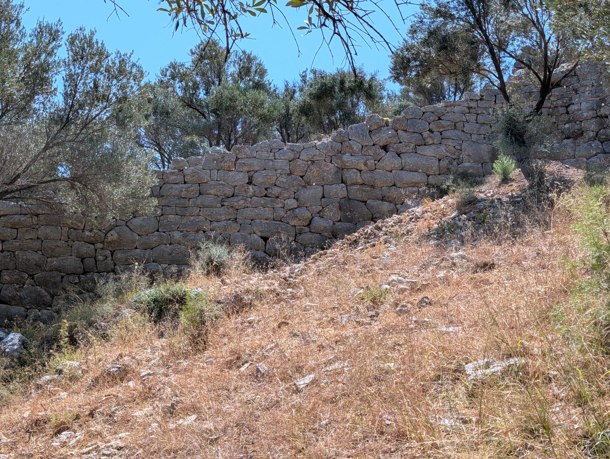
The best-preserved stretch of the settlement's fortification walls is on the northern and northwestern slopes, where substantial sections of the curtain wall survive together with five towers. Older descriptions generally give their surviving height as around 3-4 metres, although some sections of the fortifications have been reported as reaching considerably higher in places. The towers are predominantly solid rather than hollow, an arrangement that provided projecting points from which the wall could be defended. One particularly interesting feature noted in studies of the fortifications is an unusual opening in the curtain wall, which has been interpreted as a later modification associated with the use of artillery. The southern stretches are much less complete, partly because erosion and the steep terrain have destroyed or obscured sections of the circuit.
The main surviving gateway lies in the northern part of the circuit. Its position is significant: rather than being placed at the easiest point of approach, the entrance was incorporated into a strongly defended section of the wall, with a tower immediately associated with the gateway. Remains of an access arrangement and projecting wall near the gate have also been noted in architectural studies. From here, the defensive line continues around the hill, while the interior rises towards the acropolis where the theatre and sanctuary were located. The arrangement makes the original logic of Amos unusually easy to understand: the city was built around a defensible summit, with the walls exploiting the natural slopes and the sea providing an additional barrier on several sides.
The date of the fortifications deserves a little caution. They have traditionally been dated to the 4th century BCE, largely on the basis of their masonry techniques, and this dating is supported by Anthony McNicoll and by T. Saner's detailed 1994 study of the walls. The surviving circuit, however, is not necessarily the product of a single building campaign. Saner identified several masonry techniques, while later studies have suggested that the original wall was subsequently strengthened, repaired or modified.
For a visitor today, the fortifications are perhaps more rewarding than they initially appear. The northwestern wall and towers are particularly impressive, and walking along them gives a good sense of how dramatically the ancient settlement occupied the summit. Look beyond the masonry, too: the position of Amos explains why this small community could control such a commanding point above the coast. The walls protected not only the buildings on the hill but also a settlement whose territory and agricultural resources were important enough to generate the detailed Hellenistic land-lease contracts discovered in and around Amos. In other words, these are not merely picturesque ruins - they are the surviving framework of a small but economically significant community within the Rhodian Peraia.
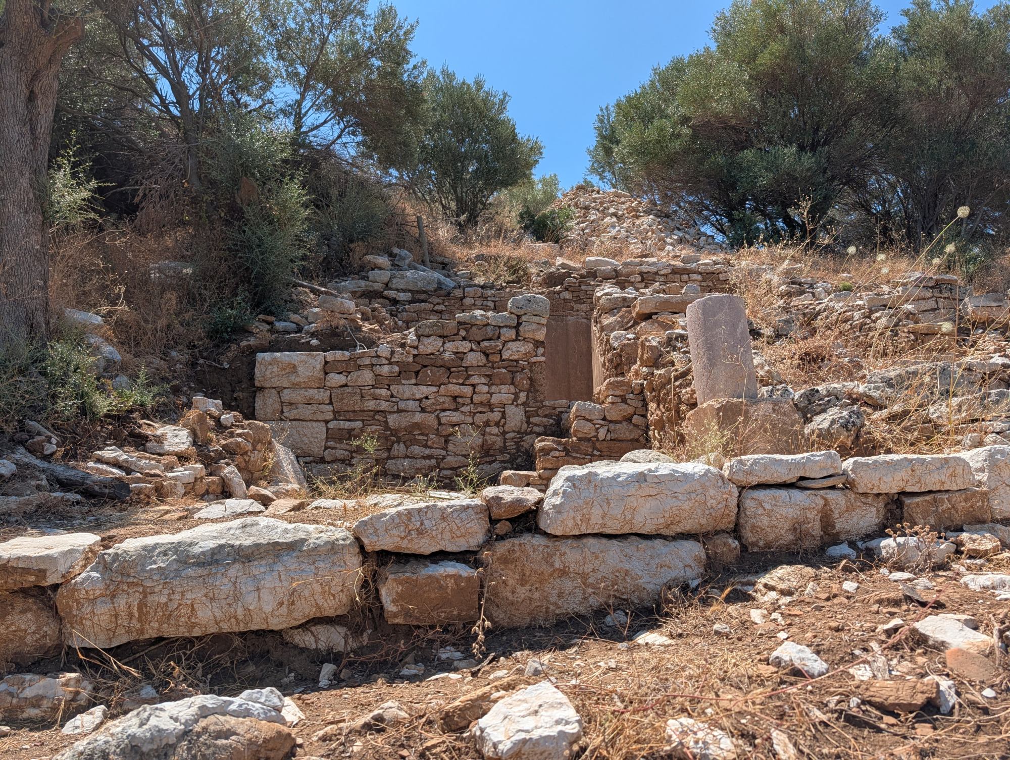
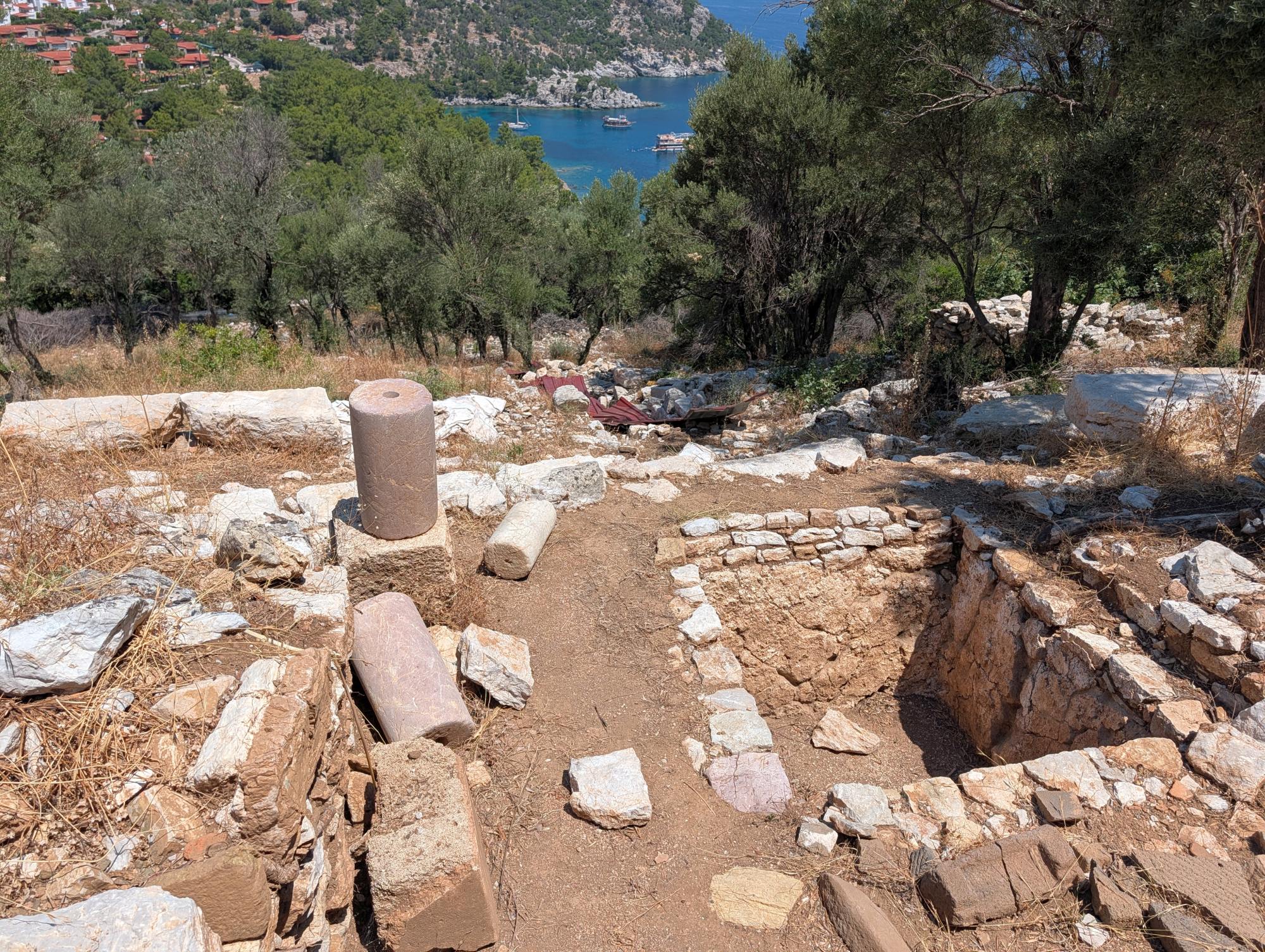
Leaving the fortifications behind and following the route towards the theatre, you pass one of the most interesting areas of the modern excavations at Amos: the newly investigated civilian sector on the eastern side of the theatre. This part of the settlement was largely absent from the earlier archaeological accounts, which concentrated on the fortifications, the theatre, the sanctuary, and inscriptions. Excavations conducted since 2020 have begun to expose a group of civilian buildings, including rooms with plastered walls and mosaic floors. The work is particularly valuable because it is moving the interpretation of Amos beyond its monumental buildings and providing direct archaeological evidence for domestic life, the organisation of residential space, and the activities of its inhabitants. The excavators are also examining the stratigraphy and construction phases of the buildings in an attempt to establish how this part of the settlement developed and changed over time.
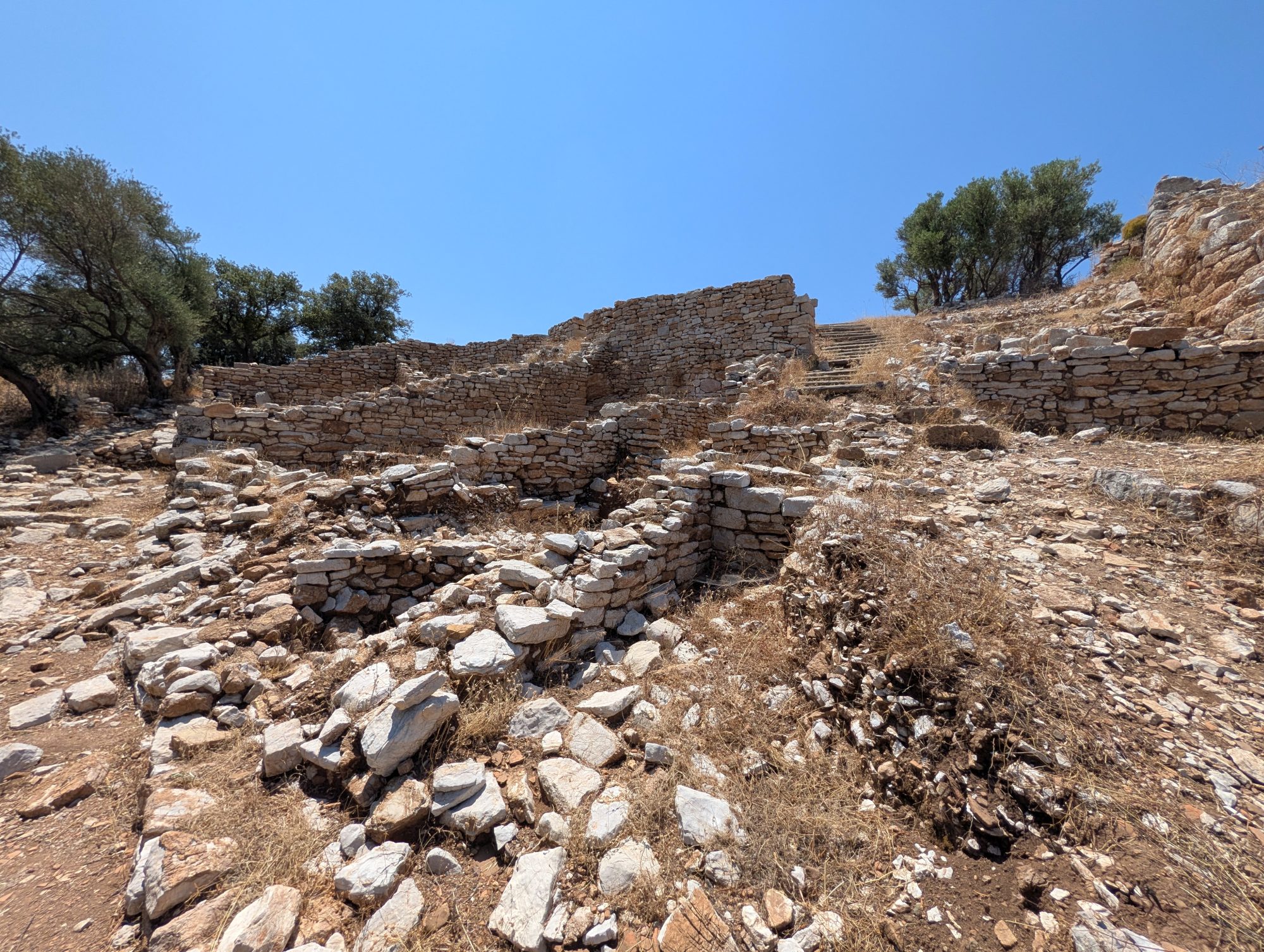
The area appears to have been more than a purely residential neighbourhood. Excavations have identified a building interpreted as a thermopolium, a type of establishment associated with the preparation and sale of food and drink, together with a nearby space interpreted as a storage area. Ten amphorae were found in this sector, providing additional evidence for the storage and movement of goods. These finds suggest that the area around the theatre combined different forms of urban activity rather than being divided into strictly residential and commercial zones. The discovery is particularly useful for understanding the practical functioning of Amos, complementing the documentary evidence from the Hellenistic land-lease inscriptions, which already demonstrated that the community possessed a productive agricultural territory.
The architecture is still being investigated, and it would be premature to describe the excavated remains as a completely exposed "residential quarter". The archaeological team has been deliberately extending the excavation area and recording the dimensions, arrangement, construction techniques and chronological relationships of the buildings. One of the aims is to determine how many residential units existed in this part of the city and what their arrangement might tell us about the size and organisation of the settlement. The presence of mosaics and carefully finished plastered surfaces indicates that at least some of these buildings were furnished to a reasonably high standard, although it would be unsafe at present to use this alone to reconstruct the social status of their occupants.
The discoveries also help put the monumental centre of Amos into a more convincing urban context. The theatre, for example, was not standing in isolation on an otherwise empty hilltop. It formed part of a built-up settlement in which houses, commercial premises, storage facilities, streets, and public buildings existed alongside one another. This is particularly significant at Amos because the surviving fortifications can otherwise create the impression of a small military stronghold. The new civilian-sector excavations instead suggest a more complex community whose inhabitants lived, traded, stored agricultural products, and participated in the civic and religious life of the polis.
For visitors, however, there is an important practical distinction between what has been archaeologically discovered and what can currently be visited. As of July 2026, the newly excavated residential sector remains an active archaeological work area and is closed off to visitors. Excavation and conservation are continuing, so some of the structures visible from the visitor route may be only partially exposed and may change considerably as further layers are removed, and architectural relationships become clearer. This is one of the places at Amos where the archaeological story is literally being written in front of us: what appears today as a few walls, floors, and fragments of rooms may eventually become part of a much more complete picture of how this small city was organised and how its inhabitants lived.
Immediately to the south of the theatre there is a substantial public cistern, one of the practical installations that helped sustain life on Amos' exposed hilltop. Its circular reservoir measures approximately 5.5 metres in diameter and is 3 metres deep, and its scale suggests that it served a communal rather than purely domestic purpose. Although less visually impressive than the theatre or fortifications, the cistern is an important reminder that the survival of a settlement in such a prominent but water-poor location depended on carefully planned infrastructure. Its position beside the theatre also places it within the heart of the ancient city's public and residential landscape.

For visitors, the cistern offers a useful glimpse into the everyday engineering behind Amos' monumental architecture. Water had to be collected, stored, and distributed before the city's inhabitants could maintain houses, workshops, public buildings, and religious activities on the summit. The structure has been incorporated into the continuing programme of archaeological investigation and conservation, and its relationship with the wider water-management system is still being studied. Rather than viewing it simply as an empty reservoir, it is worth seeing the cistern as part of the infrastructure that allowed Amos to function as a permanent community on this otherwise difficult hilltop site.
Beyond the cistern, the route brings you to the theatre of Amos, the most imposing public building on the hill and arguably the most impressive surviving monument in the city. Built into the natural slope of Asarcık hill, the theatre takes advantage of the steep terrain rather than requiring a massive artificial embankment. Its seating area rises at a notably steep angle of about 33 degrees, while the surviving retaining walls (analemmata) demonstrate the care with which the builders adapted the structure to the rocky hillside. With a capacity of roughly 1,000 spectators, it was modest in size compared with the great theatres of cities such as Ephesus or Pergamon, but its scale was appropriate for Amos and its local community. Recent research dates its original construction to the late 3rd century BCE, probably around 200 BCE, rather than simply to the 2nd century BCE as was stated in some earlier accounts.
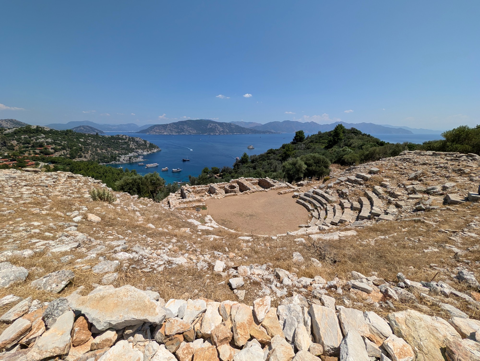
However, the theatre underwent an important modification around the middle of the 2nd century BCE. Its originally single-storey stage building was transformed into a two-storey structure, while the orchestra and other elements were reorganised. Excavations have also revealed evidence of a substantial fire in the stage building, together with earthquake damage in its western section. These remains have been associated with the violent seismic events that affected Amos in the 3rd century CE, after which the theatre ceased to function. The combination of fire and earthquake evidence is particularly valuable because it provides a physical glimpse of the final phase of the city's history. Standing in the orchestra today, it is therefore possible to see not only a carefully engineered Hellenistic theatre but also a monument that preserves evidence of the catastrophic events that brought its long public life to an end.
Just to the west of the theatre, on the middle terrace of the acropolis, lies the sanctuary of Apollo Samnaios, one of the most important religious spaces identified at Amos. The epithet Samnaios, usually understood as "Apollo of the hill" or "Apollo of the mountain," is particularly appropriate for a sanctuary occupying this elevated terrace. The small temple stands at the western end of the terrace, while the theatre's stage building occupies the eastern end, creating an unusual relationship between religious and theatrical architecture. The terrace itself appears to have functioned as a shared public space associated with both buildings.
The identification of the sanctuary is unusually well-supported by epigraphic evidence. During the 2020 investigations, a stone inscription found in the original location near the centre of the terrace, probably in the vicinity of an altar, was found to contain a list of priests and officials of Apollo Samnaios together with temple inventories. This provided the crucial evidence for securely locating the cult of Apollo on the middle terrace and confirmed that the small temple at its western end belonged to Apollo Samnaios. Only limited architectural remains of the temple survive today, but its position, the inscription, and associated architectural fragments make this one of the most securely identified sacred spaces at Amos.
For the visitor, the sanctuary is also an important reminder that Amos' public life was not confined to its theatre. The temple and theatre stood at opposite ends of the same terrace, and the excavators have suggested that the space between them may have accommodated activities connected with the Dionysiac cult, although this remains an interpretation rather than a demonstrated fact. The arrangement is therefore worth viewing as a deliberately organised civic and religious landscape, in which performance, worship, and communal activity occupied the same prominent terrace. The sanctuary is currently being incorporated into the continuing excavation, conservation, and environmental works at Amos, so some of its remains may be restricted while archaeological work continues.
From the theatre and the sanctuary of Apollo Samnaios, the route climbs in the western direction towards the highest terrace of Amos, the acropolis, where the remains of another Hellenistic sanctuary occupy the summit. This is one of the most significant results of the recent excavations because the sanctuary was not securely identified in the earlier descriptions of Amos. The excavated remains are now considered to belong probably to Athena, although the identification should be treated as provisional rather than absolute. The temple occupies the highest and most prominent point of the settlement, and architectural and sculptural evidence has strengthened the comparison with Athena sanctuaries elsewhere in the Rhodian sphere. Recent excavations also recovered fragments believed to have belonged to a cult statue, together with terracotta lamps and other objects associated with the sanctuary.

The summit is particularly rewarding as the natural conclusion to a visit to Amos, not only because of the sanctuary but because of the commanding views. From here, the ancient settlement's position becomes immediately understandable: the fortified hill projects between the two bays, while the surrounding coast and hills form the wider landscape of the Rhodian Peraia. The elevated position would have given the sanctuary considerable visual prominence, while the view also reveals why Asarcık was such an attractive location for a fortified settlement. It is worth pausing here before descending, as the summit brings together much of what makes Amos distinctive - its defensive position, civic buildings, sacred terraces, and close relationship with the surrounding agricultural and maritime landscape. The sanctuary itself remains an active subject of archaeological investigation, so some features may still be difficult to interpret from the ground and access restrictions may change as excavation and conservation continue.
Beyond the fortified settlement, the slopes around Amos' hilltop city preserve its necropolis, providing a final and very different perspective on the ancient community. The main burial areas lie outside the fortifications, particularly on the slopes below and around the northern and northwestern sides of the city, extending down from the fortified hill towards the surrounding landscape. Their position outside the defensive circuit follows a familiar pattern in the Greek world, where cemeteries were generally established beyond the inhabited area. Recent archaeological work has shown that the cemetery was used over a remarkably long period, and the burials reveal a mixture of inhumation and cremation practices. Particularly important is a family podium tomb excavated in 2020. Built in the 3rd century BCE, the tomb contained ten burial compartments, with cremated remains placed in ostothekoi and urns alongside inhumations. Grave offerings included ceramic and glass unguentaria, while coins were also deposited. The tomb remained in use until the 3rd century CE, providing unusually clear evidence for the persistence and changing character of funerary practices at Amos through the Hellenistic and Roman periods.
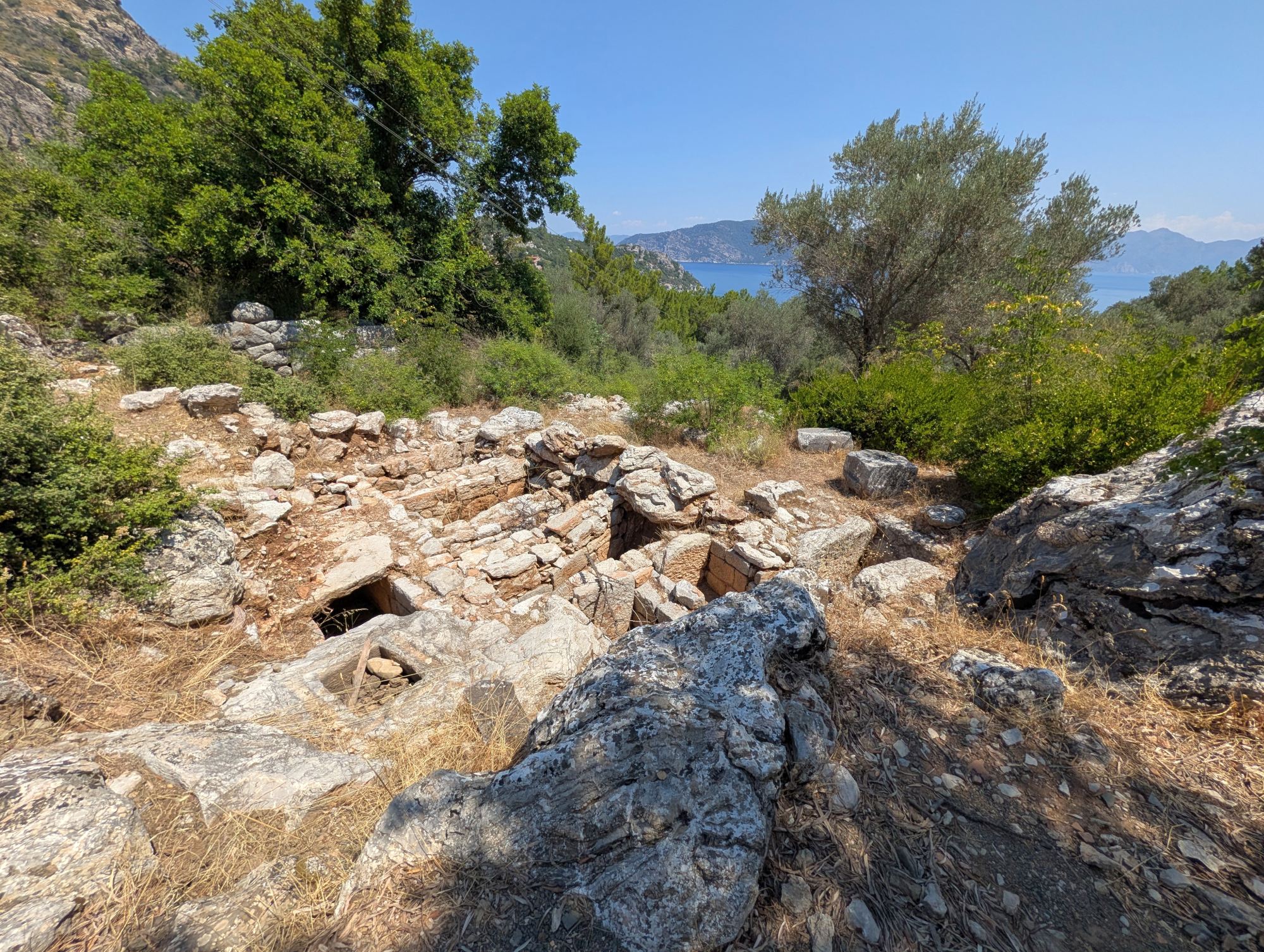
The necropolis is especially valuable because it complements what can be seen within the city itself. From the upper acropolis, looking down towards the northern and northwestern slopes, the cemetery occupies the landscape immediately beyond the walls, creating a physical transition between the city of the living and the burial grounds of its inhabitants. The houses, commercial buildings and public monuments reveal how the people of Amos lived and organised their community, while the cemetery provides evidence for how they treated their dead and expressed family identity. The coexistence of cremation and inhumation within the same tomb illustrates that funerary customs were not static, even within a single family monument. For visitors, however, the necropolis should be regarded primarily as an archaeological landscape rather than a conventional visitor monument: individual burial areas remain subject to ongoing research, the terrain is uneven, and access to excavated tombs may be restricted. Its significance is therefore best appreciated as the final chapter of the visit to Amos, extending the story of the settlement beyond its walls and into the surrounding landscape where generations of its inhabitants were laid to rest.
Visitor tips:
Amos remains a relatively undeveloped archaeological site, but it is no longer simply an unstaffed and unmanaged ruin. The ancient city is now included in the Turkish Ministry of Culture and Tourism's Geleceğe Miras ("Heritage for the Future") programme, which supports archaeological excavation together with conservation, environmental improvements, and the presentation of sites to visitors. At Amos, the programme has been supporting work since the recent excavation campaigns, and the 2026 season began on 20 July, with improvements to the walking route, civilian buildings, the necropolis, and the theatre, as well as vegetation clearance, maintenance, and repairs. Work is also underway to strengthen the protective barrier around the viewing terrace and improve visitor safety.

There is still no officially published fixed daily opening timetable or staffed ticket office for Amos, and the site remains freely accessible, with no entrance fee and no requirement for a MüzeKart. This should nevertheless be regarded as the situation during the current development phase rather than a permanent arrangement: as Amos is being progressively incorporated into a more formal archaeological and visitor-management system, access arrangements could change. In particular, the 2026 excavation and conservation programme means that some areas may be temporarily fenced off or inaccessible even when the wider site can be visited.
A visit requires sensible preparation. Amos occupies an exposed hilltop, and the route involves uneven archaeological surfaces, rocks, steps, and steep sections. Comfortable, sturdy footwear is therefore essential, while water, a hat, and good sun protection are strongly recommended, particularly in summer. There are few visitor facilities at the ruins themselves, so it is best to bring everything you may need for the duration of the visit rather than relying on finding refreshments or other services on the hill. A leisurely visit of around 1.5-2 hours should allow enough time to appreciate the fortifications, civilian buildings, the cistern, the theatre, the sanctuaries, and viewpoints without rushing. An early-morning or late-afternoon visit is preferable in the hotter months.
Because Amos is an active archaeological site, visitors should expect to see excavation areas, protective barriers and sections of the ancient city undergoing conservation. The newly excavated civilian sector and parts of the necropolis, for example, may not be accessible even though they form an important part of the archaeological landscape. The ongoing Geleceğe Miras programme means that what you see today is very much a site in transition: archaeological remains are being exposed, documented, and conserved while the visitor route and safety infrastructure are simultaneously being improved. For this reason, barriers should always be respected, and visitors should not enter excavation areas or climb on ancient walls and structures.
One final advantage of visiting Amos now is that you can see archaeology in progress. Unlike the heavily restored and highly managed archaeological centres of western Türkiye, Amos still retains something of the atmosphere of an archaeological discovery. At the same time, the Heritage for the Future programme is gradually providing the protection and infrastructure needed to make the site easier and safer to understand. The balance is likely to change considerably in the coming years, making a visit during the present phase particularly interesting for anyone wanting to see both the ancient city and the process by which a relatively little-known archaeological site is being brought back into the public eye.
Getting there:
The easiest way to visit Amos is from Turunç, from where the ancient city is reached by following the road towards Kumlubük. The archaeological site lies on the Asarcık hill above the road and Kumlubük Bay, and the final approach is on foot. From the road, a clearly marked archaeological path leaves the road and climbs approximately 220 metres to the summit, with wooden steps installed on the steeper sections. The road journey from Turunç to the entrance is straightforward, although the final climb to the ruins means that Amos is not suitable for visitors with serious mobility difficulties.
From Turunç, Amos is roughly a 5-6 km walk each way by the road approach, making it around a 10-12 km round trip. The walk is exposed in places and includes an uphill approach to the archaeological site, so in summer it can be demanding. A taxi from Turunç is therefore a convenient alternative; in July 2026, I paid 500 TL for the one-way journey. The taxi can take you most of the way to the archaeological site's entrance, leaving only the relatively short uphill walk to the ruins.
Whichever option you choose, the final approach to Amos should be treated as a short archaeological hike rather than a conventional museum visit. From the entrance, the path climbs through the fortifications before reaching the main remains on the hilltop. Allow extra time if you would like to explore the entire archaeological area and the viewpoints over Kumlubük Bay and the surrounding coast. In the summer heat, the combination of the exposed hillside and uphill approach makes an early-morning or late-afternoon visit particularly advisable.
- Log in to post comments