Archaeological site:

Description:
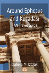
This text is a fragment of a guidebook to Ephesus: "The Secrets of Ephesus".
Curetes Street is one of the main thoroughfares of Ephesus. It leads from the Library of Celsus to the Hercules Gate, extending along a northwest-southeast axis, in the saddle between the Panayir and Bülbül hills. Curetes Street can be considered the link between two main areas of Ephesus - the political and the commercial one. After leaving the Lower Agora, the walk uphill along this street takes the visitors to the vicinity of the Upper Agora, the political heart of ancient Ephesus. Its strategic location meant that Curetes Street's role was not only purely practical as the communication link between two parts of Ephesus. It was also a part of the processional route that was followed to celebrate the city's chief goddess, Artemis. Finally, similarly to the Arcadianne, Curetes Street played the role of an ostentatious boulevard, created to impress the visitors and show off the wealth of Ephesus.
In antiquity the street was most possibly called Embolos, literally meaning a wedge, as this name is mentioned not only in literary sources but also confirmed by the inscriptions discovered in the area of the street and the Commercial Agora. This name could be the reflection of the street's location as it was wedged in the narrow valley between two hills. Thus, the street did not follow the orthogonal grid plan of the Greco-Roman city as the shape of the valley dictated its course. The name used currently, Curetes Street, comes from the priests called the Curetes, who took care of the flame of the Prytaneion where their names were written down. The column drums from the Prytaneion, covered with lists of the cult association of the Curetes, were reused in the lower north colonnade of the street where they were discovered by archaeologists.
Astonishingly, this street was used for a thousand years at least, as evidenced by the excavations. The earliest archaeological traces of the street date back to the 3rd century BCE. In this period, the lower Embolos consisted of a gravel road that was later delimited by a curb. In the Roman period, the street was first paved with marble stones. Along Curetes Street there were once fountains, statues, and shops, of which those located on the southern side had two storeys. The street also had a well-developed sewer system underneath. The street was originally 210 meters long, and from 6.8 to 10 meters wide. It is rather steep, with the elevation of around 20 meters, and it climbs from the Triodos Square in the direction of the State Agora.
The street was frequently damaged by the earthquakes, for instance in the 3rd and 4th centuries CE. Because of that, the buildings along Curetes Street were repeatedly damaged and then underwent refurbishment. After the earthquake in the 4th century CE, the collapsed columns were replaced by others, collected from the various areas of the city, including the ones taken from the Prytaneion. The resulting confusion of architectural styles can be seen to this day.
In the early Byzantine period, Ephesus underwent a construction boom, resulting from renewed prosperity of the city. In these times, also Curetes Street was refurbished, including the restoration and reconstruction of the monumental fountains situated at the lower section of the street. At the same time, the street was closed to traffic when the Hercules Gate was erected on its eastern end. The street continued to function until the 6th or even the 7th century CE as the archaeologists found taverns and workshops of the craftsman quarter from this period in the areas bordering the street.
This text is a fragment of a guidebook to Ephesus: "The Secrets of Ephesus".